Photo Record
Images

Metadata
Title |
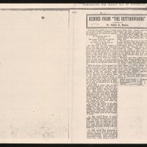
Map of Haverhill 1795, article by Mabel D. Mason, Echoes From "The Buttonwoods" |
Object Type |
Photocopy |
Description |
Article concerning the oldest map of Haverhill (1795), by Mabel D. Mason, from the "Echoes From 'The Buttonwoods'" column. The article is eleven paragraphs in two columns. The map discussed in the article is "An Accurate Plan of Haverhill Laid down from an actual Survey Taken June 1st 1795 by James C. McFarland & Josiah Noyes," see HK1.2 Senter G5x7 7-29. The article describes the map's features including bridges, rivers, ponds, streams, mills, streets, and churches. In another paragraph Mason notes the 1899 map of Haverhill by Sidney Perley, and at the end she discusses the 1832 map published by James Gale; the last line at the bottom of the first column is cut off. Mason notes this map's features including name changes of rivers or streams, ponds and lakes, hills, streets, commons, and positions of mills and ferries. |
Date |
n.d. |
Processing Method |
Photocopy |
Print size |
22 x 28 cm |
Original/Copy |
Photocopy / EP |
Call Number |
HK1.2 Senter HPH 56-784A |
Catalog Number |
31479006607856 |
Subjects |
Haverhill (Mass.) Maps |
Place |
Haverhill, MA |
People |
Mason, Mabel D. McFarland, James C. Noyes, Josiah Perley, Sidney |
Search Terms |
Haverhill Maps Mabel D. Mason Mason James C. McFarland McFarland Josiah Noyes Noyes Sidney Perley Perley |
Collection |
Haverhill History Collection |
Provenance |
Found in collection. |
Digital Collection |
Senter Digital Archive |
Copyright Statement |
Copyright is not held by the Haverhill Public Library. The library retains custodial rights. |
Related Records |
Show Related Records... |
Last Updated |
2022-03-01 |

